
Drue Ripp Blog
Subscribe and receive email notifications of new blog posts.
 RSS Feed
4
Mt. Hood's Clear Lake Hike Worth the Trip
Mt Hood's Clear Lake a Popular Destination
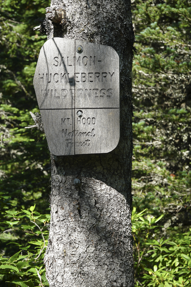
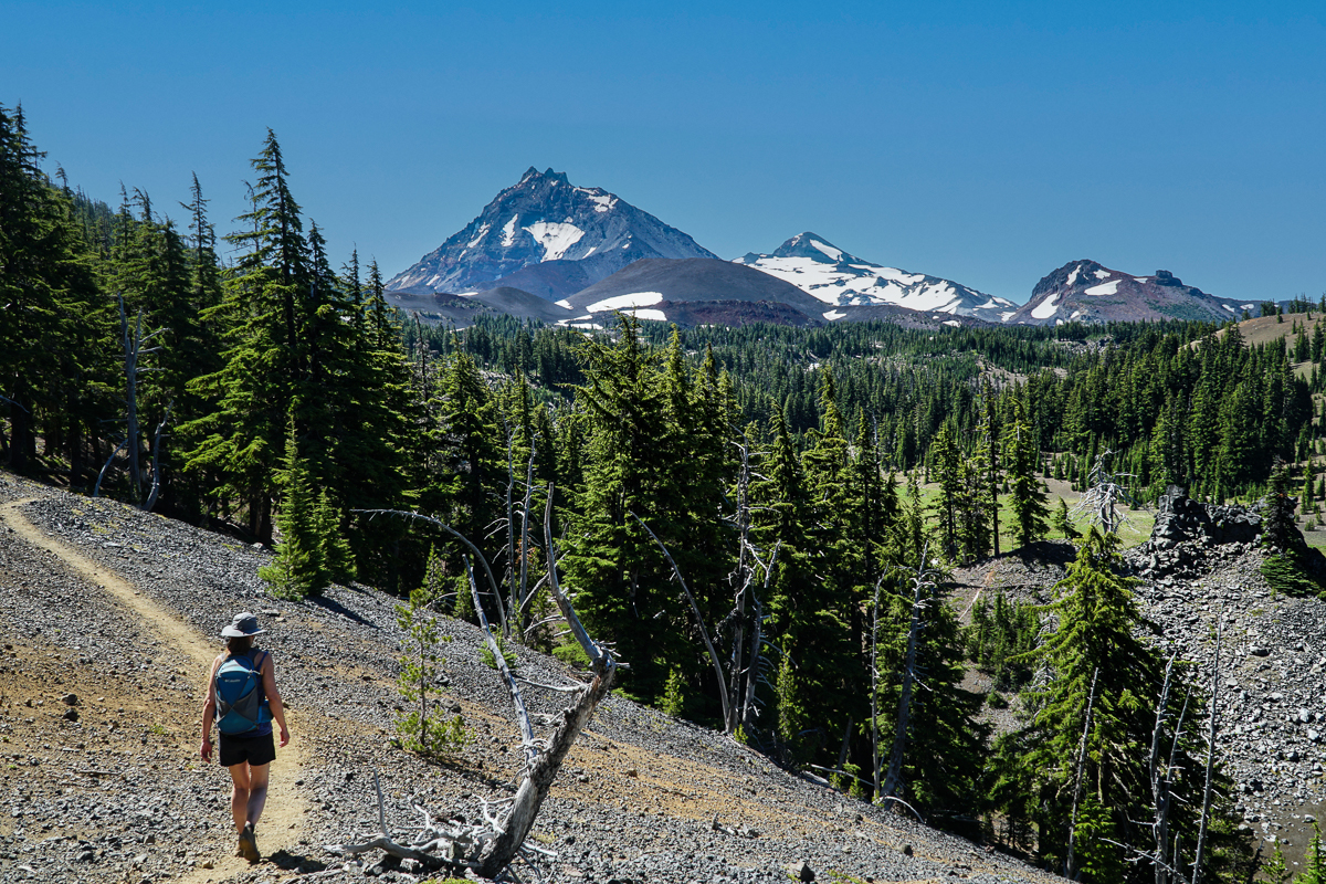
With the recent heavy smoke Central Oregon has been experiencing from the Bedrock Fire, we expanded our hiking locations to include the Mt. Hood area. Last Saturday we enjoyed the hike to Clear Lake, a popular hike located just off Hwy 26 by Skibowl in the Mt Hood National Forest. We started our hike just after 9:00 am after our two hour drive from Bend, and found the parking lot practically full. The hike to Clear Lake was well marked and typically is an easy to moderate in and out loop trail around the lake with roughly 300 feet of elevation gain. 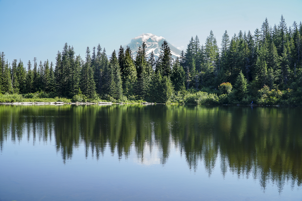 However, past the lake, which has lovely views of Mt. Hood on a clear day, there is an option to hike up Tom, Dick and Harry Mountain in the Salmon - Huckleberry Wilderness, a trip that provides for over 1700 feet of elevation gain and lengthens the total hike to over 8 miles.
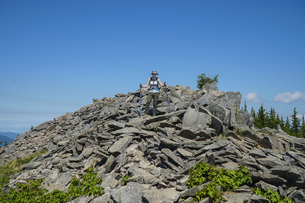
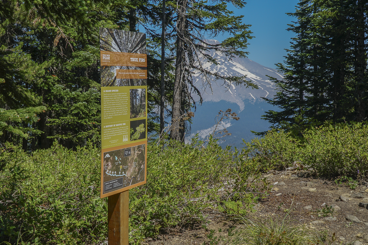
Upon reaching the rock filled overlook, we continued on another 1/2 mile to the actual summit on Tom Dick Peak, which we discovered is part of SkiBowl recreation area, clearly not part of the Salmon-Huckleberry Wilderness. Our GPS showed an option to hike down through the ski area, which we did. This involved traversing several diamond runs and connecting with the unused mountain bike trail. Our hike down to the Skibowl buildings by the parking lot was extremely steep and what took over 4.5 miles to gain in elevation we lost in just over 1 mile. We do not recommend this route for most people. However, it was a beautiful day with wonderful views of Mt Hood and a pleasure to be out of smokey Central Oregon.
 |
|
27
Balloons Over Bend This Weekend!
Balloons Over Bend Starts Friday
There is a fascination with watching colorful hot air balloons rising at sunrise in the Central Oregon sky with the backdrop of the Cascades and the high desert landscape. Starting this Friday, the annual Balloons Over Bend festival will run through Sunday offering daily sunrise launchings of the hot air balloons, Night Glow Friday evening in Bend and Saturday evening in Redmond, plus many fun activities for the whole family during the day. The planned schedule is as follows:
Friday July 28, 2023
- Balloon launches at Sunrise at RE Jewell Elementary School
- Balloon blast kids race at COCC
- Bend Night Glow at COCC
Saturday July 29, 2023
- Balloon launches at Sunrise at RE Jewell Elementary School
- Redmond Night Glow and Brewfest at the...
24
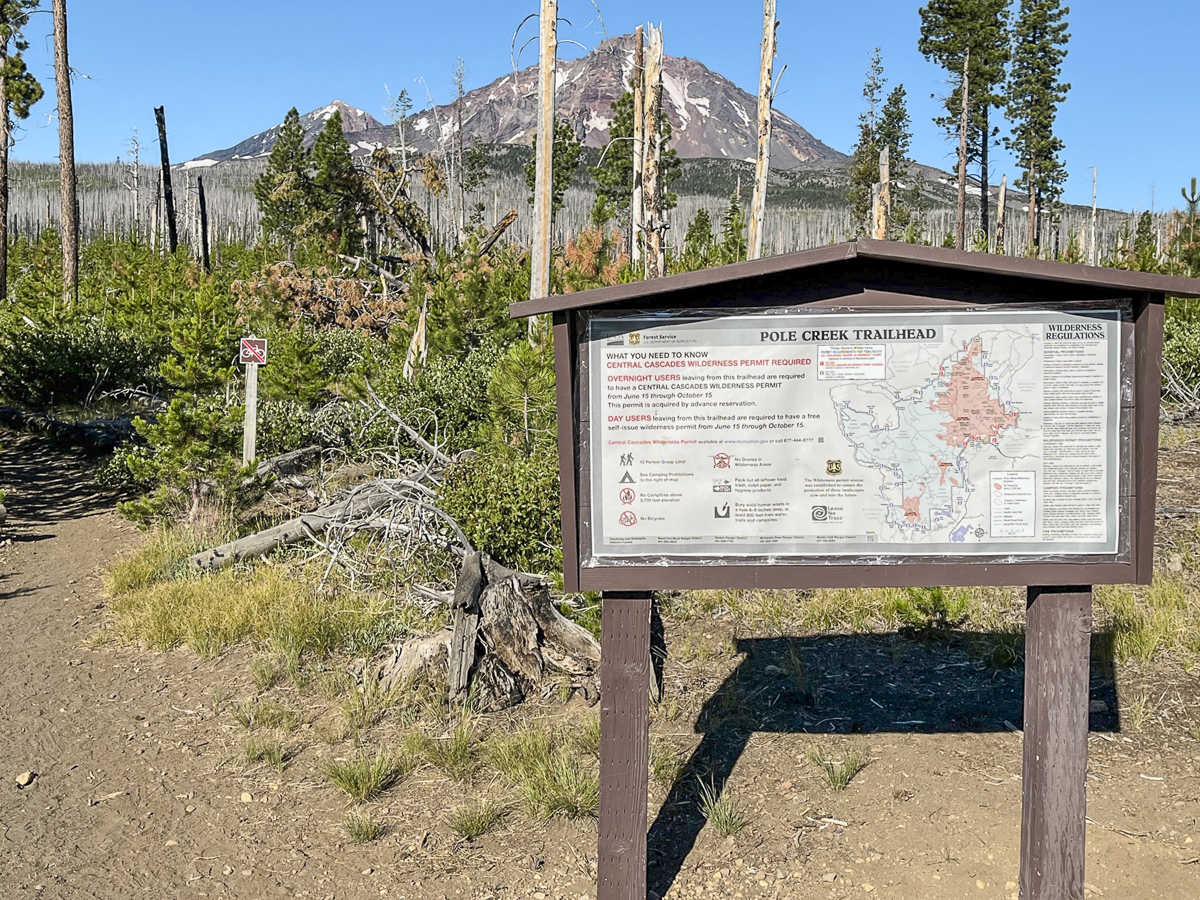
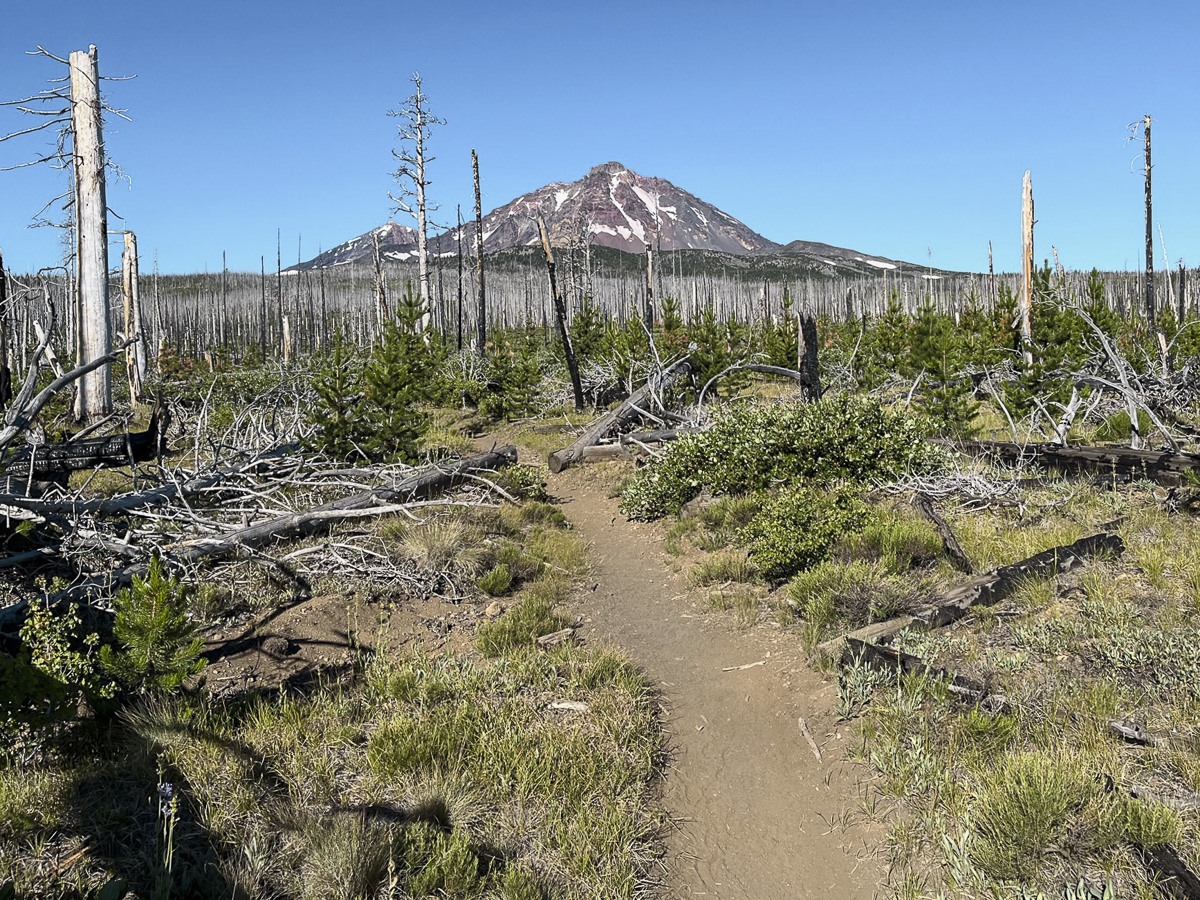
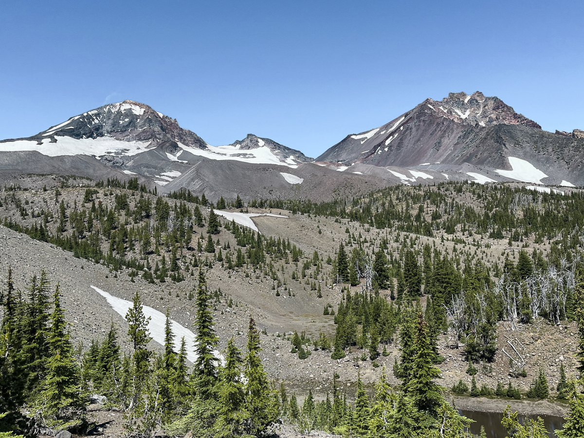
Camp Lake is a Challenging Hike in the Three Sisters Wilderness
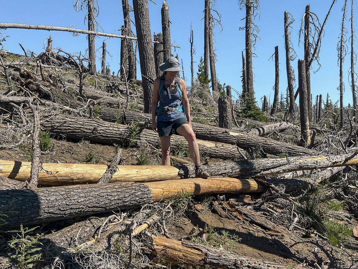
We have hiked to Camp Lake annually over the past few years. We have always appreciated the beauty of the area with North, Middle, and South Sister as well as Broken Top dominating the skyline. However, the hike to the beauty was especially hard this year due to the heat of the July weather and the large number of fallen trees which needed to be maneuvered around.
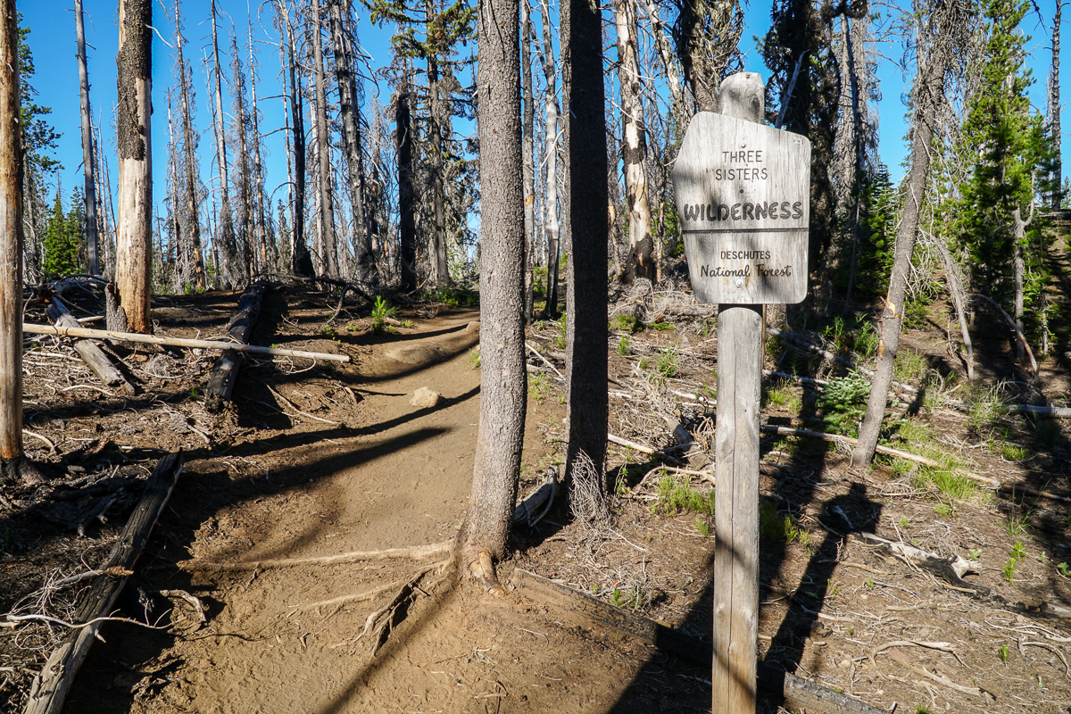
We arrived at the Pole Creek Trailhead, off forest service road 15, early in the day and started the hike in the relatively cool temperature of early morning. The first 4 miles of the hike are through the burned trees of the Pole Creek fire from 2012. The first 2 miles of this dry, dusty trail were cleared from the fallen trees, but once we turned off the main trail onto the trek toward Camp Lake, the blow down was significant. We had to step over, around and on top of many fallen trees, some of which required leaving the trail altogether and potentially losing the way. In situations like this, we rely on GPS. Once reaching unburned forest, the hike is much more pleasant with shade and views of the Three Sisters becoming even better as we gained elevation.
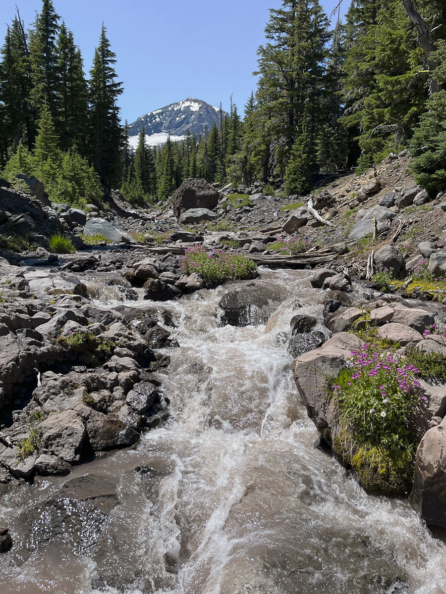 The crossing at the North Fork of Whychus Creek was challenging this year, however, with more water flowing from Diller Glacier than we had experienced in past years. We crossed upstream of the normal crossing in order to find a safe spot that would keep our feet dry.
The last few miles to Camp Lake are wonderful. Hikers feel as if they are surrounded, at least 2/3rds of the way, by the towering Three Sisters with Broken Top just over a ridge to the east. The mountains are so close it seems as if it would be a fairly easy jaunt to hike at least the lower shoulders of each of the Sisters. The air was clear and the views spectacular. Once we reached Camp Lake, we sat at the end of the water enjoying the reflection of South Sister in the clear lake water as we ate our lunch. Our stop was not long enough, but we had to return back to our car. The few people we met on the trail were backpacking and would spend the night, not doing the roughly 15 miles we did in one day. We gained around 2000 feet of elevation during the entire hike, but despite the challening path with the multitude of obstacles to get around, the experience was well worth it.
 |
 |
 |
 |
21
What Is Up With Bend Luxury Homes?
Bend High End Home Sales Reflect a Changing Market
It has been awhile since we last reported on Bend luxury home sales. We pulled a report showing year to date activity over the past three years. While Bend home prices in general are back to a small upward trajectory year over year, the numbers of sales are significantly down, as they are in all price points in most of the markets in Central Oregon and across the country. Higher interest rates have changed the buying power of would-be home purchasers, even in the high end, and have also kept many would-be sellers off market. Why sell when the mortgage interest rate many homeowners have is so good? A replacement home, while potentially being better for the current lifestyle of a home seller, may cost more on a monthly basis with the higher interest rate with which they may need to purchase.
When the first six months of high end Bend home sales are compared year over year between 2022 and 2023, the following change...
18
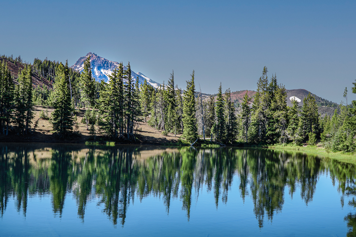
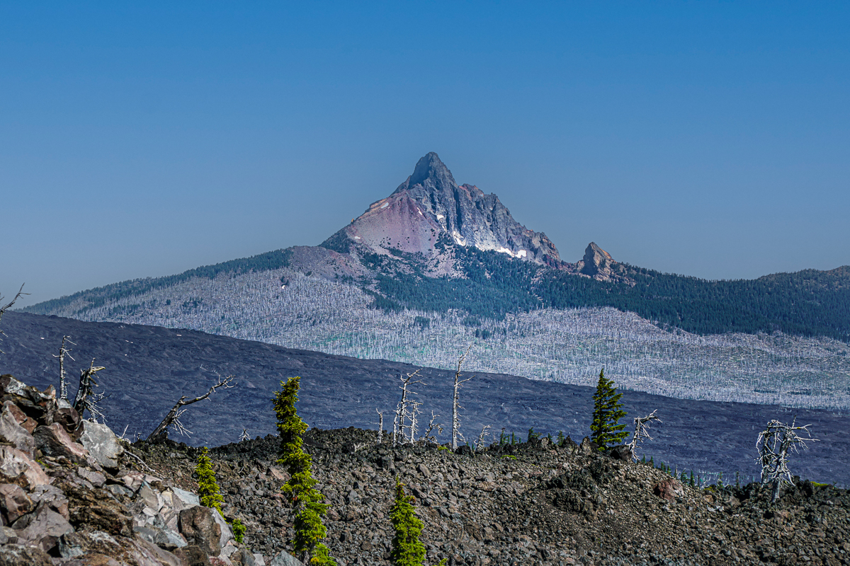
Collier Glacier in the Three Sisters Wilderness is Worth the Hike
We have hiked in the Three Sisters Wilderness many times and have always enjoyed our experience. However, accessing views of Collier Glacier can be a bit of a challenge. Located in the saddle between North and Middle Sister, Collier Glacier views, on the north edge of Collier Cone, are obtained after a seven and a half mile hike from Lava Camp Lake Trailhead through Matthieu Lakes or the Obsidian Trailhead. While only 1/2 mile off the Pacific Crest Trail, to reach the edge of Collier Cone involves a scramble up a steep pumice hill, but once you arrive, the setting is spectacular with the glacial lake and towering vistas of North and Middle Sister and Little Brother. We hiked this trail 7-15-23 during one of the hottest days of the year. Although we started the hike early, it took almost 8 hours to complete it and much of the trail was exposed to the sun in lava fields or burned forest. However, there were beautiful shaded areas near Matthieu Lakes and our experience was wonderful. We brought a lot of water and enjoyed refilling a water container at Minnie Scott Spring where water can be seen percolating through the small stones. The total hike was over 15 miles and over 2500 feet of elevation gain.
 |
 |
 |
 |
|
|